logo

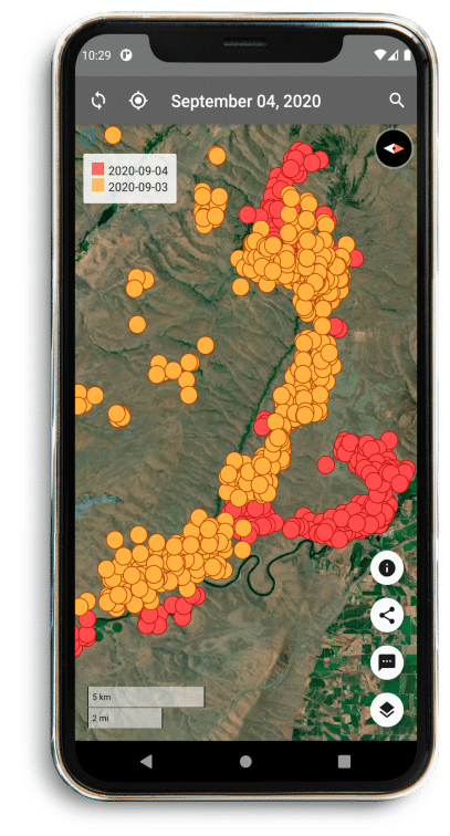
FireFringe uses satellites to detect wildfire globally

FireFringe™ was invented by experts who know forests, working with people who know fires. FireFringe can spot burning hot areas around the world like forest fires, grass fires, volcanic lava or hot areas caused by oil rigs, smelters, and other industries.

logo
phone

We keep you informed, with months of available historical blazing fire data. FireFringe gives you control of the sensitivity of the spotting tools from high sensitivity to low sensitivity—stay informed, stay safe.

Control the sensitivity of the blazing fire detection tools
Choose from one of four Mapbox basemaps
VIIRS and MODIS satellite data updated twice daily
Visualize the distance between you and fires
Displays fires globally

Find out more about FireFringetm and wildfire risk

Take Action Now